Kakadu Coast and Cobourg Marine Park survey
NT Parks and Wildlife and Australian Marine Parks partner with James Cook and Charles Darwin University to complete the first-ever detailed mapping of coastal habitats around Kakadu and the southern Cobourg Peninsula.
NT Parks and Wildlife, through Federal funding from Parks Australia, joined forces with James Cook University and Charles Darwin University to map the benthic habitat around the Kakadu coastline and the southern Cobourg coastline. These areas haven’t been mapped before and presents a first look at what is present and establishes a baseline for monitoring in the future. Special thanks also to the Kakadu National Park Rangers and Cobourg Traditional Owners who helped make this work happen.
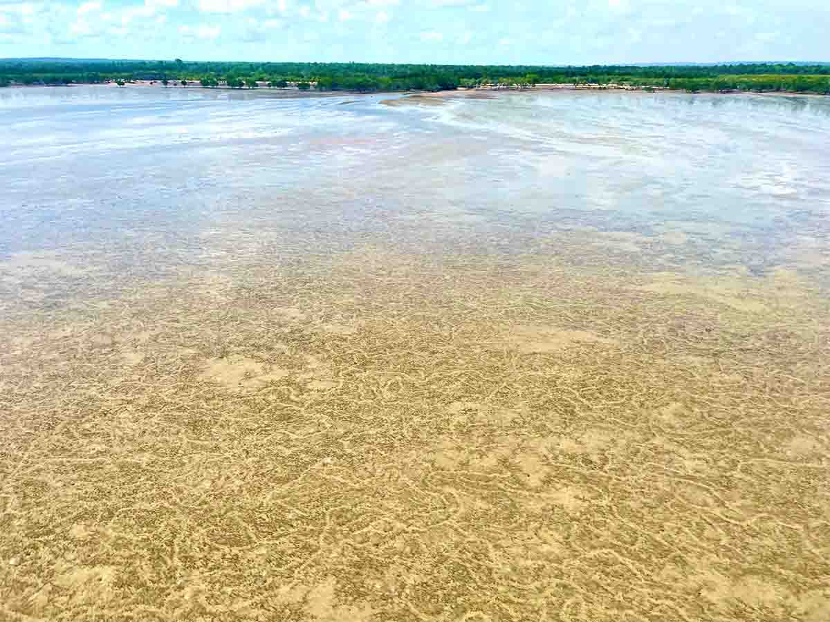
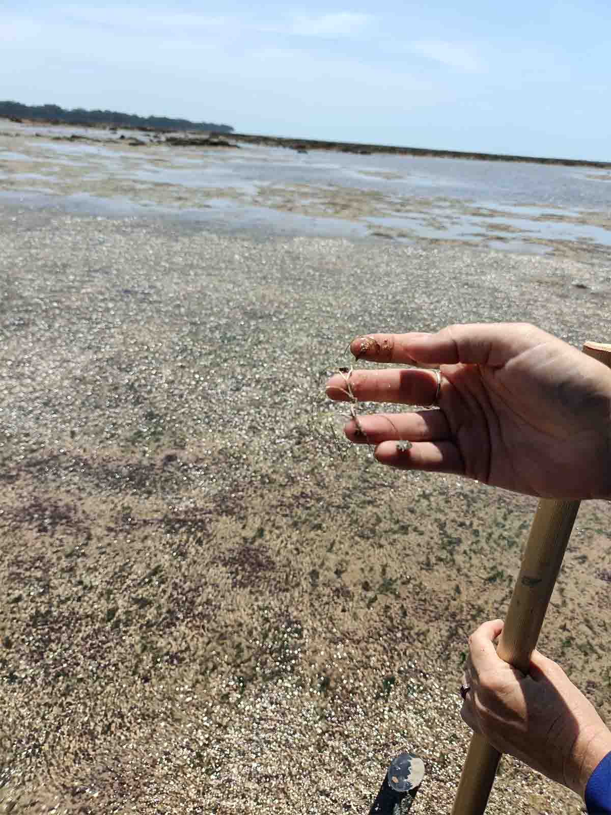
To map the benthic habitat 2 methods were used. The Helicopter method is used for intertidal mapping as it enables a lot of ground to be covered at low tide in remote environments. The surveys are also timed for the neap low tides to expose as much of the intertidal area as possible.
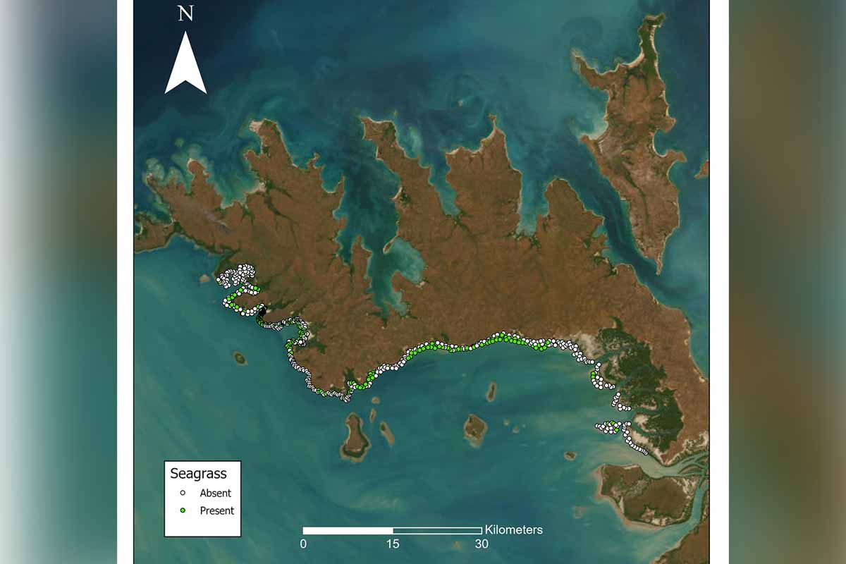
The team surveyed 421 sites at Kakadu and 617 sites at Cobourg by helicopter . The boat method is used for subtidal habitat that doesn’t get exposed at low tide and cameras are used to see what is on the sea floor. The team surveyed 272 sites to look below the water surface to depths of around 20m.
The substrate (sand, mud, reef etc) and the biological cover (algae, coral, seagrass) are assessed at all sites to map and develop a picture of what habitats exist, what their extent is, and to provide a baseline for monitoring.
Seagrass is important habitat for dugong and turtles for feeding but also provides nursery cover for many juvenile fish and crustaceans (e.g. prawns). Dugongs eat on average 40kg of seagrass a day, so large healthy meadows are important to sustain one of the most important dugong populations in Australia. Large meadows were observed with extensive dugong feeding trails.
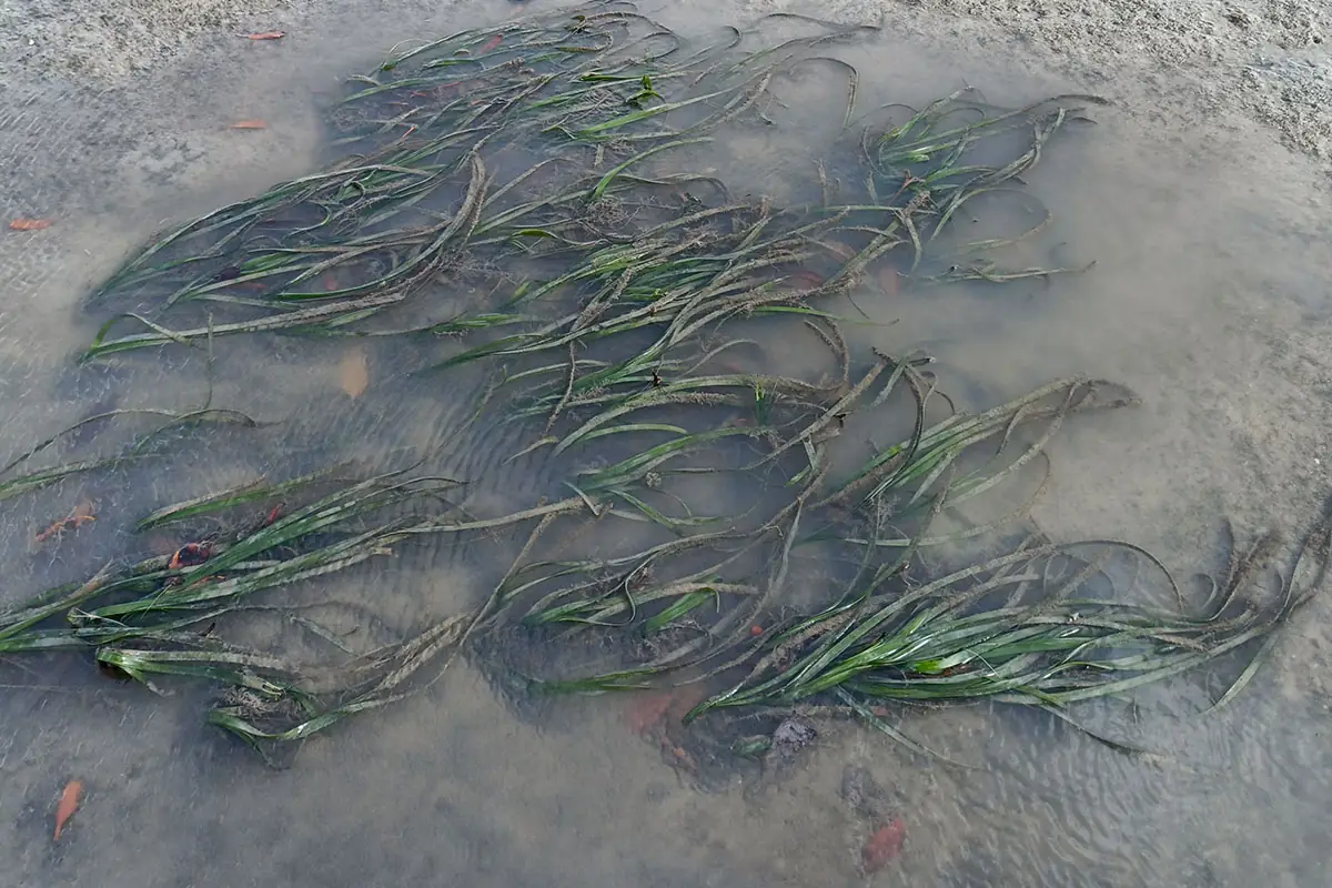
4 species of seagrass were observed, including the rare Enhalus acoroides (image included). There were also mixed seagrass and algal meadows, coral reef habitats and complex invertebrate communities of sponges, bryozoans and more.
This collaborative project provided a first look at the biological values of this coastline and will allow for monitoring of ecosystem health in the future. Funding for this was made possible through the National Environmental Science Program as well as through a Commonwealth Federation Funding Agreement supporting marine park management capacity in the NT.
Social tags and handles:
#parksandwildlifent, #ParksAustralia, #Australianmarineparks
https://www.facebook.com/NorthernInstitute
https://www.facebook.com/tropWATER